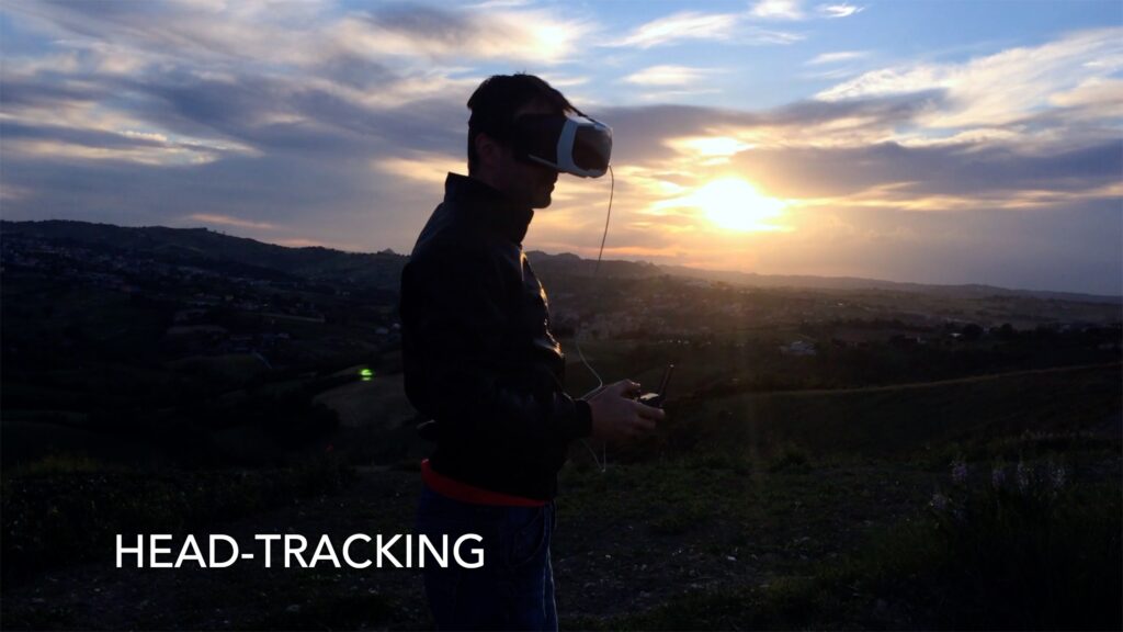
Now you can fly aboard your drone in first person immersive mode.
Gimbal Modes supported:
Normal (stabilized)
Head Tracking
FPV (not stabilized on the roll axis)
VR view is configurable in size, position and distance between the pupils, to adapt to practically all VR headsets.
Possibility to change point of view by selecting the drone or phone camera. (Particularly useful during takeoff and landing phases to ensure that the area is clear.)
Head-Tracking with “comfort tilt” mode that allows you to tilt the camera by 90° while only lowering your head by 60°.
Check the new manual for the VR function for all the details.
The update includes several bug fixes and performance improvements.
-Added Radar Tool the tool displays how the remote control and the drone are oriented towards each other automatically appears on the screen when the drone is at least 20m away from the remote controller
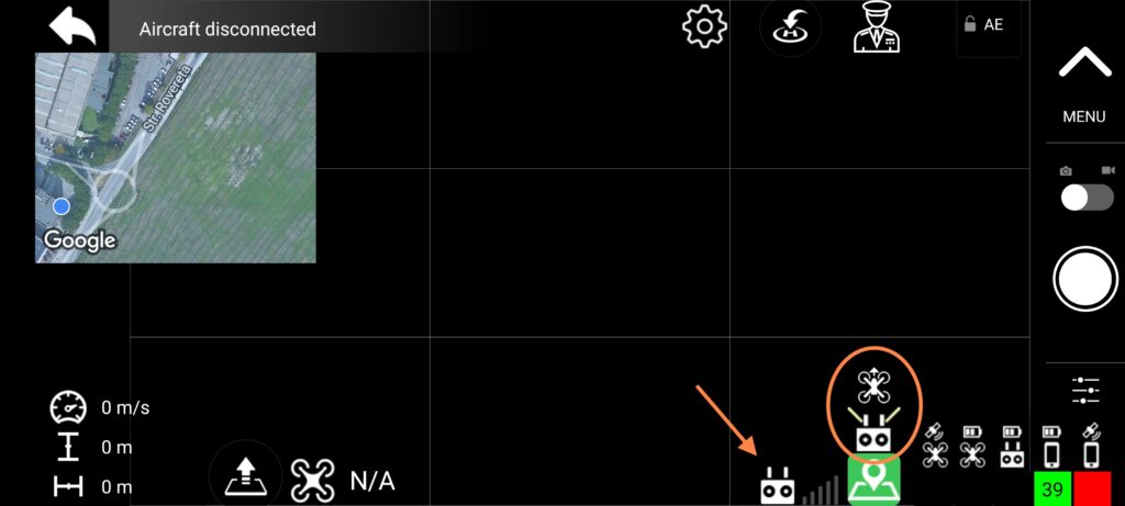
-Added tool to display signal strength operation for Ocusync drones and WIFI drones
-Added Grid on screen you can now turn the grid on and off from the camera options
-Added label indicating the distance from the POI on the augmented reality tracker
-Augmented Reality Trackers are now available even with minimized camera view (full screen map)
-The update also includes minor bug fixes
Stay tuned… we are working on the next update.. VR!!
Maven Lite 1.1.1
-fixed an issue where the image was not displayed correctly on Air 2 and Air 2s drones -fixed an issue that could cause the application to crash
In this version of the app we have modified all our source to accept translations, it has been a lot of work to make all the labels on the screen adapt correctly to the possible different lengths of the text.
We believe that the bulk of the work has been done, further translations of the app will come soon.
Maven for Android is here!! This is the first version of our app for Android devices! Tons of updates are expected in the coming months
Includes a faithful virtual co-pilot who will help you pilot the drone, allowing you to perform maneuvers such as:
POI spotlight
GPS Follow/Track ME
Cable Cam
Automatic Orbit
The app is compatible and optimized for:
Mavic Air
Mavic Air 2
Mavic Air 2S
Mavic Mini
Mavic Mini 2
Mavic Mini SE
Mavic 2 Enterprise Dual
Mavic 2 Enterprise
Mavic 2 Pro
Mavic 2 Zoom
Mavic Pro Alpine
Mavic Pro Platinum
Mavic Pro
Spark
Virtual Copilot
a totally new feature to the app, especially useful for drones without native Point of Interest functionality (e.g. Mavic Mini)
choose a point on the map, then ask the copilot to control the Yaw Rotation and the camera to look at that point while you are free to manually fly the drone
the copilot has also more advanced skills like “orbit” ,”Follow / Track ME”, “cable cam” , check the manual
the copilot will open the door to great shots even to inexperienced pilots!
Follow ME! *
a complete GPS follow functionality that include
-Track Me (follow from any direction)
-Altitude follow**
-Orbit while follow
-automatic home point update
-live follow parameter update
* requires a GPS-equipped device ** requires a Barometer Sensor-equipped device
Cable Cam
Unique function that allows you to take smooth shots of your points of interest. Also great for creating hyperlapses.
Orbits
Orbits to the max! No other app allows you the flexibility to change orbit radius and speed while it’s running! A real fun
AR Localizer
You have three Augmented Reality Localizer that will help you orient yourself on the Drone video feed.
The green locator will always show the Home position, the red one will show you the Position and Distance of a Point of Interest that you can choose on Map. The blue one show the GPS position of the piloting device
GPS Error, compass error or barometer sensor error could affect the accuracy of the localizer but will always be a great help to find your destination.
Complete access to all camera settings
Sync flight logs to AirData UAV
The variety of android devices is so high that we can’t be sure it works on every device, and we can’t test them all, so to avoid selling you an application that might not work we decided that you can download and try the application for free.
It will be impossible to record videos from the drone while using the virtual copilot. Video recording will be unlocked via an in app purchase
The app require Android 7 or higher. A device equipped with GPS is required for “follow / track me” functionality. A device equipped with Barometer sensor is required for ” altitude follow” functionality.
improved the transition to a different radius during a high speed orbit
improved automatic yaw during follow me
Improved stability and fixed minor bugs
Maven 3.11.7 – change log
Fixed a “small” incompatibility with iOS 16.1 made the app extremely slow to the point of crashing when editing the Waypoint missions.
Maven 3.11.6 – change log
Fixed incompatibility with the Air 2S and the latest firmware (October 27, 2022)
Now with the mini, mini2 and mini SE the load mode (propeller cage) is automatically disabled when needed (most of the app functions require it to be disabled)
Maven 3.11.5 – change log
This update contains bug fixes and performance improvements:
Fixed an issue that prevented WiFi-only iPads from showing drone distance
Fixed an issue that prevented the map from working correctly when a drone was connected but had not yet locked onto the GPS satellites
Fixed an issue that prevented the exposure lock button from being visible on some devices
Reduced the size of augmented reality trackers
Reduced CPU load when using virtual stick missions and when using virtual geofences, optimizing processes and eliminating unnecessary ones
This update does not contain new features, but we believe it is important that all existing ones should work at their best, and there is always room for improvement.
I leave you with a video of a test done with this latest version of Maven running on an old iPhone 5S
This update is focused on supporting new drones -DJI Mini 2 -DJI Air 2S -DJI Mini SE
All functions of the app are available with the new drones
Added on-screen Exposure Lock Button
Small bug fix and performance improvements
For sure this is the most anticipated update ever, Mini 2 owners are so many! and this puts us in front of a huge amount of new potential customers that we already welcome.
We are really excited about this update but it doesn’t stop us from working on future developments right now.
I invite all new customers to watch this video to get a small preview of the potential of the app, and then visit the tutorial section of the site.
If you are new to Maven, I inform you that there is a group on FB where to discuss, exchange information and useful tricks on how to use Maven or simply share your own videos made with Maven. https://www.facebook.com/groups/938321600163115/
We are working h24 for the release of the most anticipated Maven update ever with the support you have Mini2, Air 2s, Mini SE drones
From the very first tests the SDK integrates without problems, so the “beta” phase will probably not last long. However we are not going to release the app in a hurry, everything must be perfect when the update reaches the app store!
To celebrate the release of the SDK we have decided to discount the app which goes from $ 17.99 to $ 9.99 We will keep the discounted price until we release the update! ***discount ended***
In addition, we open the Beta version for free to “everyone” (100 places available) To download the beta, just follow this link: ***link full***
Virtual Copilot 2.0! It can now focus on you, and therefore it can do:
Follow Me
Altitude Follow
Track Me (follow from side)
Orbit Me (while following)
Camera frame option (middle or bottom)
Automatic update of the Home Point
up to 60km/h (37mph)
We recommend watching this tutorial:
Other Virtual Copilot improvement:
Cable Cam Max Speed 15m/s (up from 10m/s)
Improved Automatic Yaw Smoothness
New feature for all supported drones
Course Lock
Home Lock
this are two Headless Mode, learn more down below
New option for the camera view
Fit to Width
Fit to Content
Grid! Now (finally) you can have a grid on the screen, turn it ON in the app settings
On screen Device GPS status
Improved AR Locator
now works in minimized video windows
now react correctly and adjusts to the optical zoom of the Mavic 2 Zoom
The update also include
Fix of minor bugs
UI tweaks
This update includes 2 “old” intelligent flight modes, Course Lock and Home Lock, which DJI has removed from the new drones, and which we repurpose in our app following repeated requests. In the video that I link below it is explained what it is
This Maven update brings a feature to automatic missions that will make your head spin !!
Now there is the possibility to turn any waypoint into an orbit or spiral! check out this video tutorial we have prepared! and to follow the entire change log of the update!
change log:
Mission Planner Improvements:
add the possibility to transform any waypoint into an “orbit waypoint”
modifying the parameters of the “orbit waypoint” you can create any orbit or spiral in your autonomous mission
orbit parameters:
radius
number of laps
final radius
final height
add the possibility to transform a waypoint into a POI
added the possibility to assign tags to the mission to classify it, there are predefined tags and the user can add other customized ones
Improvements to the “by flight” function:
now you can save POIs
Improvements to the mission list:
sorting
now you can choose to sort the list by modification date, mission name or mission location.
filter
now it is possible to filter the list of missions by tags or by mission location
Minor improvements to the graphical interface
(who doesn’t like rounded corners?)
recompiled for full compatibility with iOS 15
other small improvements under the hood to make it more responsive and ready for future updates
Maven app has just been updated again. In this update we have included 2 new features that will greatly help you plan your mission 1) Above ground (altitude option) 2) define Mission “by Flight”
both new functions will help you define the mission where the heights of the terrain or the object you want to shoot are unknown to you.
Above the Ground:
The elevation information is taken from different internet database